What interesting destinations are included on the tourist map of Quang Binh? Where should you go when visiting Quang Binh? Check out the latest updated map of tourist destinations in Quang Binh to be ready for your upcoming trip. With the tourist map of Quang Binh in hand, introducing Quang Binh tourism, you won’t have to worry about where to go, how to get there, arranging convenient travel schedules, and fully exploring Quang Binh tourism.
Overview of Quang Binh tourist map
Quang Binh province is located in the Central region of Vietnam, and it is the narrowest province in Vietnam (measured by the shortest distance from the Laos border to the East Sea is 50km). It borders Ha Tinh to the North, Quang Tri to the South, the East Sea to the East, and Laos to the West.
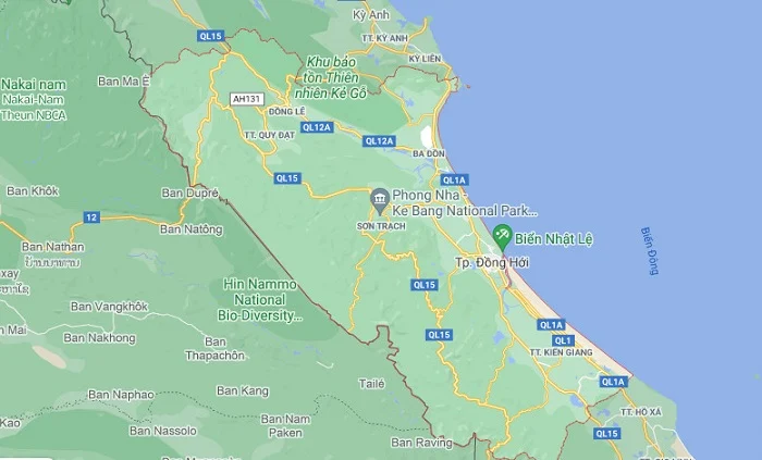
Quang Binh has a natural area of 8,065 km2, with a coastline of 116.04 km to the East and a shared border with Laos of 201.87 km to the West. This is an area with abundant natural resources, conveniently connected to other regions. Overall, there is great potential for tourism development.
Tourist map to Phong Nha – Ke Bang National Park
The tourist map of Phong Nha – Ke Bang shows that Phong Nha – Ke Bang National Park is geographically located across the communes of Tan Trach, Thuong Trach, Phuc Trach, Xuan Trach, and Son Trach in Bo Trach district, Quang Binh province. It is famous for its limestone karst formations dating back millions of years, along with a system of over 300 caves and majestic underground rivers.
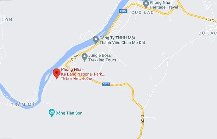
Phong Nha – Ke Bang National Park is a UNESCO World Natural Heritage Site recognized for its outstanding criteria of biodiversity, ecology, geology, and topography.
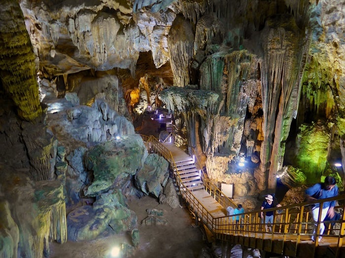
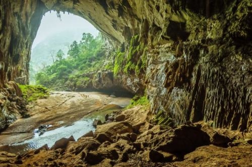
Phong Nha Cave
Phong Nha Cave is the most prominent cave in the Phong Nha – Ke Bang National Park area, stretching nearly 8 kilometers. It possesses a system of numerous underground rivers, being evaluated as one of the longest cave systems in the world. Phong Nha Cave is surrounded by lush green tropical forests, exhibiting a combination of romance and grandeur.
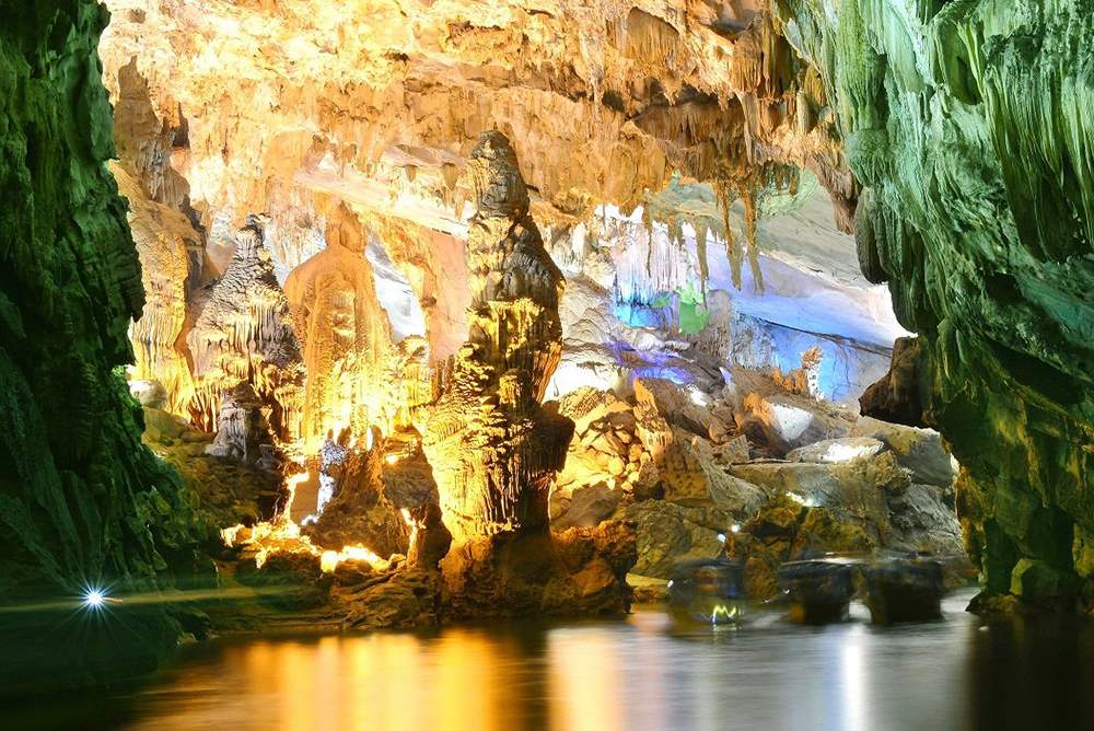
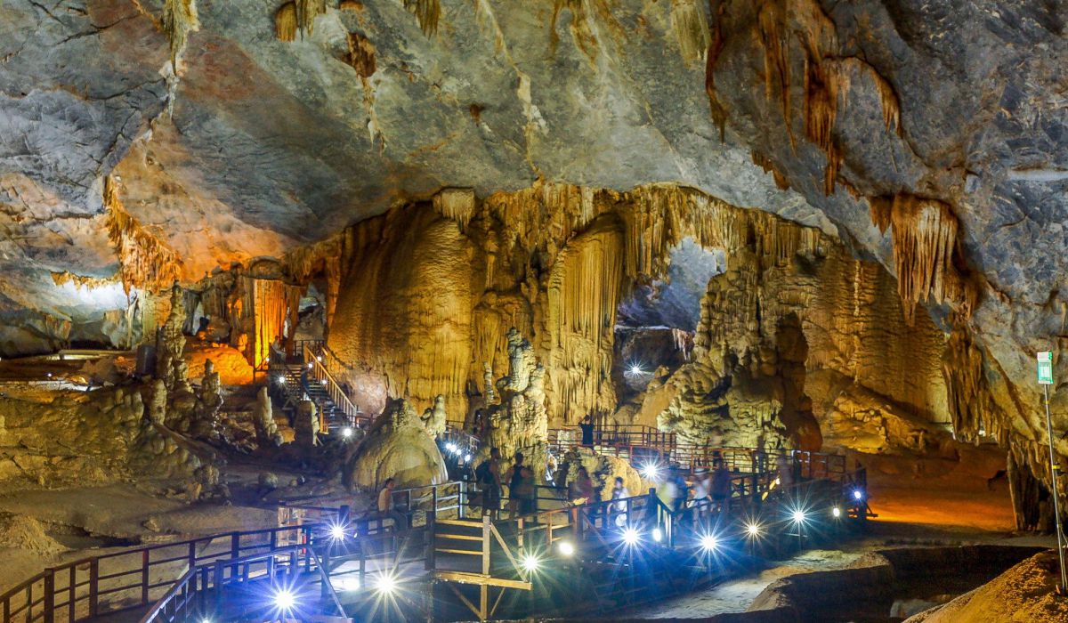
Tien Son Cave
Tien Son Cave, also known as Dry Cave (to distinguish from Phong Nha Cave, which is a water cave), features beautiful natural scenery with colorful stalactites, shimmering with beautiful hues of calcite, making visitors feel as if they are wandering in a fairyland.
Paradise Cave
Paradise Cave is a dry cave, regarded as the most magnificent and mystical wonder in the world. It is one of the most spectacular caves in the Phong Nha – Ke Bang National Park area, surrounded by pristine primary forests, attracting tourists with various exploration tours.
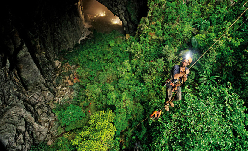
Son Doong Cave – a must-visit destination on the Quang Binh tourist map
Son Doong Cave is part of the Phong Nha – Ke Bang cave system and is considered the world’s largest natural cave at the present time. It is part of a cave network connected to over 150 other caves, featuring extraordinary stalactite masterpieces, underground rivers, and notably, a primeval forest thriving within the cave.
Tam Co Cave
Tam Co Cave is located within the Phong Nha – Ke Bang National Park and is a spiritually appealing tourist destination for many travelers. It preserves the legendary story of the bravery and sanctity of eight young volunteers amidst the Truong Son mountain range.
En Cave
En Cave is the world’s third-largest cave, an unmissable destination in exploring Son Doong. It stands out with its stacked limestone formations, colorful stalactites, and special stone crevices where swifts build their nests.
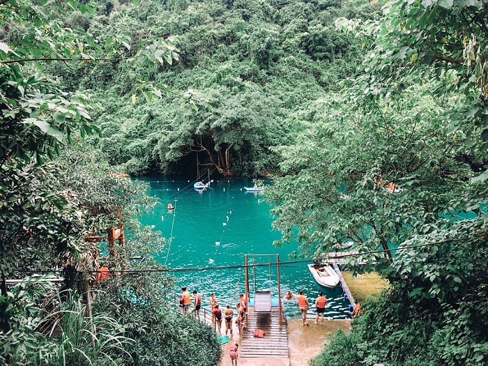
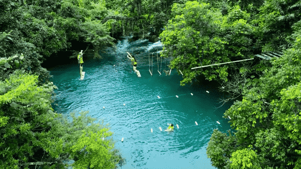
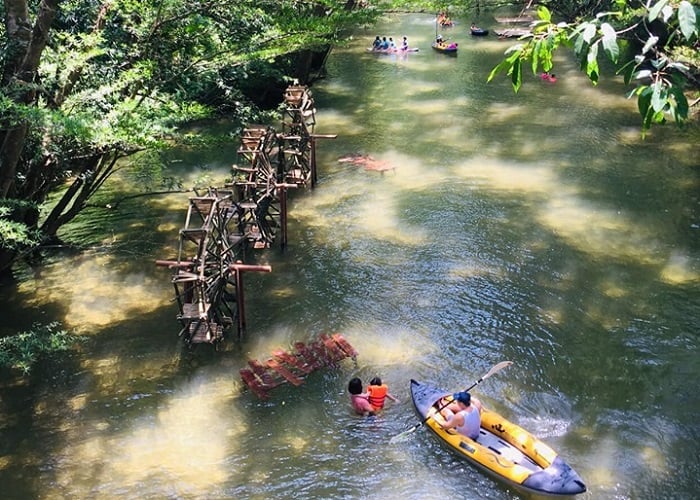
Chay River – Dark Cave
The Quang Binh tourist map cannot overlook the journey to explore the Chay River – Dark Cave. This is a newly emerging tourist destination in Quang Binh, within the Phong Nha – Ke Bang National Park, offering various exciting activities such as kayaking, river activities, mud bathing in Dark Cave, and ziplining across the Chay River.
Mooc Spring
In the Quang Binh tourist map, exploring Mooc Spring is a must. It is an attractive destination boasting vibrant natural scenery, diverse ecosystems, cool green trees, pristine mountains and forests, fresh air, and clear, cool streams.
Ozo Park
Ozo Park is located within the Phong Nha – Ke Bang National Park, a captivating destination on the Quang Binh tourist map, featuring the longest tree-top adventure system in Vietnam. Additionally, it houses diverse caves and flora, bearing many characteristics of the limestone mountain forest ecosystem.
Windy Waterfall (Gio Waterfall) – Botanical Garden
The Windy Waterfall – Botanical Garden conservation area is within the Phong Nha – Ke Bang National Park, possessing pristine and majestic beauty, with primeval forests and a rich ecosystem of flora and fauna.

The Phong Nha – Ke Bang National Park area stands out on the Quang Binh tourist map. To fully explore the attractive destinations here, it’s advisable to choose accommodations in the central area of Dong Hoi City for convenient travel and exploration.
Tourist map of Dong Hoi, Quang Binh
Tourism in Dong Hoi, Quang Binh has been thriving in recent years, becoming a popular destination for many travelers. The city of Dong Hoi is situated along the picturesque Nhat Le River, with long stretches of pristine coastline, smooth sandy beaches, clear blue waters, and numerous historical sites, making it increasingly attractive to visitors.
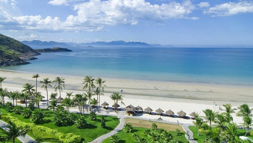
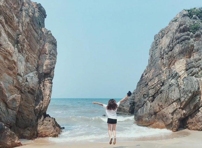
Nhat Le Beach
Nhat Le Beach is situated at the mouth of the Nhat Le River, just 1 kilometer from the center of Dong Hoi city. It stands out with its white sandy beaches, crystal-clear waters, and preserved natural beauty, making it an ideal destination for relaxation.
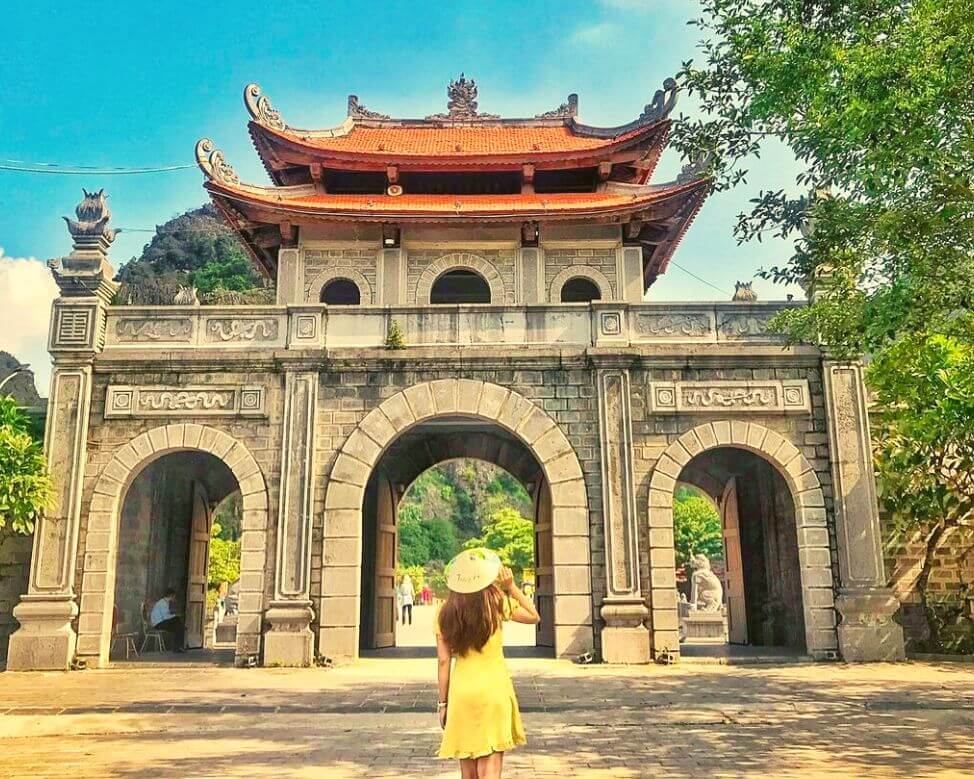
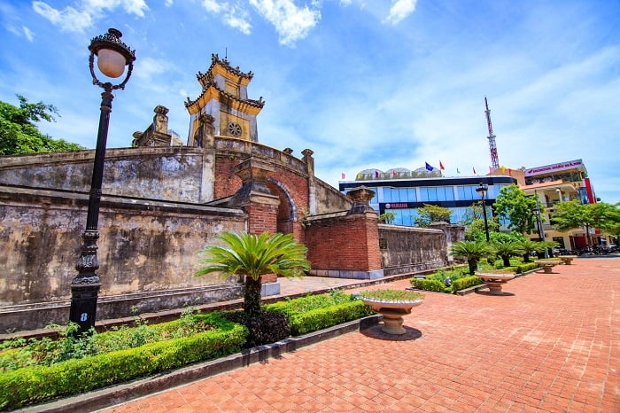
Quang Binh Citadel
Quang Binh Citadel is located in the heart of Dong Hoi city and is a historically significant destination on the Quang Binh tourist map. This sturdy fortress was built in 1639 during the Nguyen dynasty, featuring unique architectural models. It served both as a formidable defensive stronghold and as a remarkable artistic architectural structure.
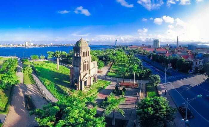
Tam Toa Church
Tam Toa Church is situated in the Dong Hoi city area, near the Nhat Le River. It is a historically rich site, bearing witness to war and serving as a haunting reminder of a turbulent period in the country’s history. The church boasts an impressive Gothic architecture, making it an attractive architectural landmark, albeit carrying a sad and tragic story.
Mother Suot Monument
The Mother Suot Monument, with its upright posture holding an oar beside the Nhat Le River, is an unmissable destination on the Quang Binh tourist map. Erected in 2003, the monument commemorates Mother Suot, a heroic Vietnamese woman, leaving a lasting impression on visitors.

Quang Phu Sand Dune
Quang Phu Sand Dune offers visitors an experience akin to being in a desert. The sand dunes here retain their pristine beauty, with breathtaking landscapes and environments untouched by human interference. The long stretches of white sand running up to the azure coastline immerse visitors in fascination and enchantment.

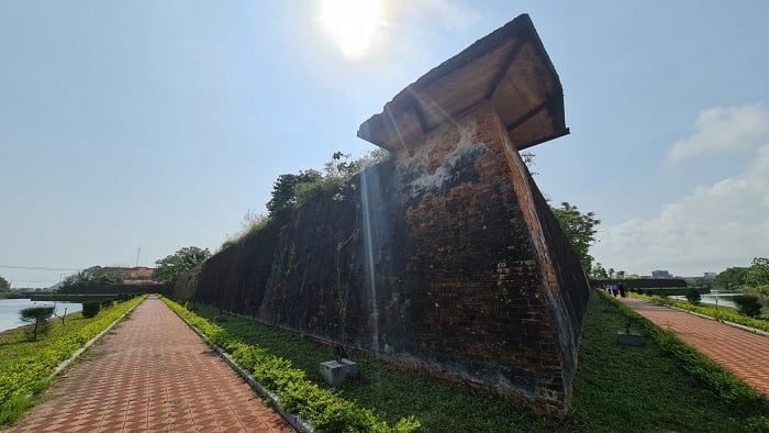
Dong Hoi Citadel
Dong Hoi Citadel is a newly attractive destination for tourists on the Quang Binh tourist map, featuring unique architectural elements, located in the heart of Dong Hoi city. Here, you can leisurely stroll under rows of trees, through lush green grass surrounding the ancient citadel, and immerse yourself in the serene atmosphere.
Dong Hoi Night Food Market
The Dong Hoi Night Food Market is an enticing tourist destination, drawing visitors with a variety of entertainment and recreational services. At the Dong Hoi Night Food Market, you can enjoy the romantic ambiance of Dong Hoi city by the Nhat Le River and savor numerous delicious specialties of Quang Binh.

Tourist Map of Quang Binh Province to the North
The Tourist Map of Quang Binh Province to the North features several prominent attractions that draw visitors’ attention, such as Ngang Pass, Princess Lieu Hanh Temple, Vung Chua – Swallow Island, Da Nhay Beach, and Canh Duong Mural Village.
Da Nhay Beach
Da Nhay Beach, a highlight on the Quang Binh tourist map, attracts visitors with its picturesque and majestic landscape, resembling a charming and harmonious feng shui painting. The beach is adorned with numerous rocks blending seamlessly together, creating a masterpiece of art by the seaside.
Canh Duong Mural Village
Canh Duong Mural Village stands out with its unique and vibrant artistic works, featuring lively 3D paintings. The mural route starts from the Ancestral Temple and stretches along the coastline, beloved by tourists.

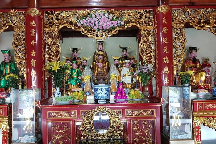
Princess Lieu Hanh Temple
Princess Lieu Hanh Temple, located at the foot of Ngang Pass, is a famous spiritual tourist destination known for its sanctity. Visitors who come to Princess Lieu Hanh Temple pray for health, fortune, and peace for their families, relatives, and friends.

Vung Chua – Swallow Island
Vung Chua – Swallow Island is a newly emerging destination on the Quang Binh tourist map, situated at the summit of Mount Tho and Rong Cape, the final resting place of General Vo Nguyen Giap, a national hero of the Vietnamese people. Vung Chua – Swallow Island boasts stunning natural scenery.
Ngang Pass – Hoanh Son Quan
Ngang Pass is an unmissable destination when traveling to the northern part of Quang Binh Province, preserving significant historical values as it once marked the border between Dai Viet and Chiem Thanh in ancient times.
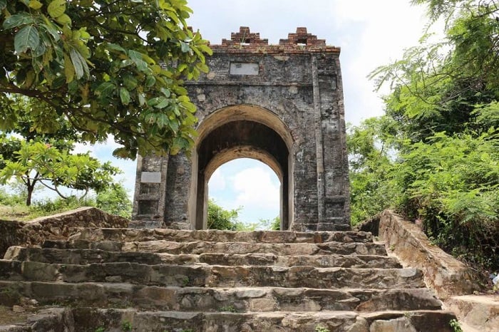
Although Hoanh Son Quan is no longer intact as it used to be, it still stands firm and majestic at the summit of Ngang Pass, exuding a profound sense of dignity.
Tourist Map of Quang Binh Province to the South
The Tourist Map of Quang Binh Province to the South focuses on many famous tourist destinations in Quang Binh Province, such as Mount Thien Dinh, Bang Hot Spring, Hoang Phuc Pagoda, and the tomb of Lieutenant General Nguyen Huu Canh.
To facilitate the exploration of tourist destinations in southern Quang Binh Province, choosing accommodation in the central area of Dong Hoi City, with many amenities and attractive services like Melia Vinpearl Quang Binh, is ideal.
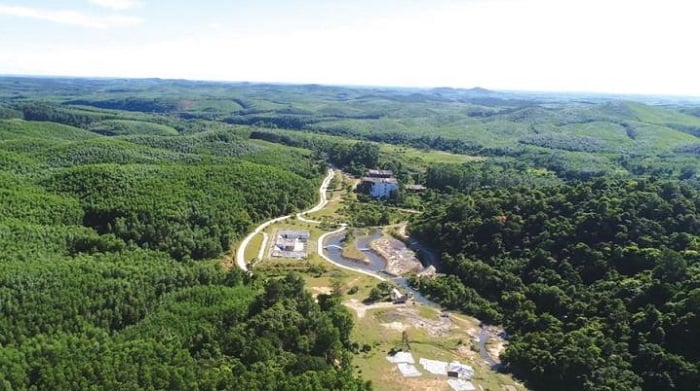
Bang Hot Spring
On the tourist map of southern Quang Binh Province, Bang Hot Spring is an ideal destination for visitors to combine sightseeing with health treatments for diseases such as skin diseases, joint and bone ailments, and neurological disorders. Bathing in the hot springs of Bang is believed to have therapeutic effects due to its rare trace elements.
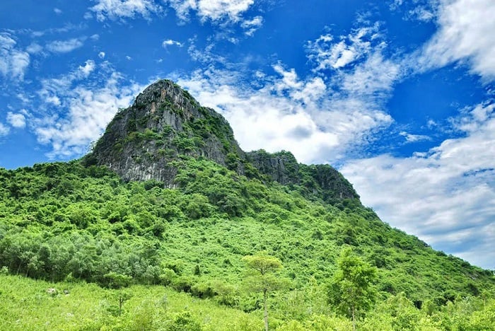
Mount Thien Dinh
Mount Thien Dinh, also known as Mount Bat Nghia or Non Temple Mountain, reigns over the sacred land known as “Head of the Eagle, Many Fairies; Thien Dinh, Many Buddhas” (according to local people). Legend has it that Mount Bat Nghia earned its name because most mountains in Quang Binh face south, while Mount Thien Dinh faces north, so ancient kings considered it a rebellious mountain.
Memorial Temple for Truong Son Martyrs at Long Dai Ferry Landing
The Memorial Temple for Truong Son Martyrs at Long Dai Ferry Landing is a significant and appealing tourist destination on the Quang Binh tourist map, bearing witness to the heroic achievements of former soldiers and youth volunteers in the resistance war against the United States.

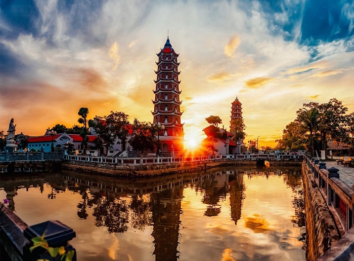
Hoang Phuc Pagoda
Hoang Phuc Pagoda in southern Quang Binh on the tourist map is one of the oldest historical sites, with a history spanning over 715 years. The pagoda is very sacred, so don’t forget to stop by and pay homage when visiting Quang Binh.
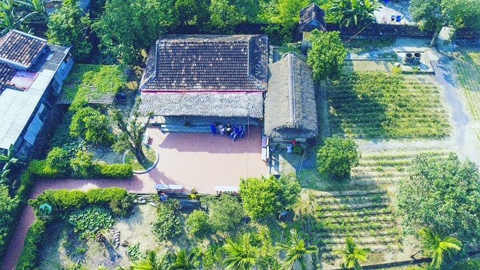
General Vo Nguyen Giap Memorial House
The General Vo Nguyen Giap Memorial House is a familiar and intimate tourist destination in Quang Binh for many people nationwide. It is an impressive destination on the Quang Binh tourist map to express admiration and gratitude for the talented general of the Vietnamese people, the elder brother of the Vietnam People’s Army, Vo Nguyen Giap.
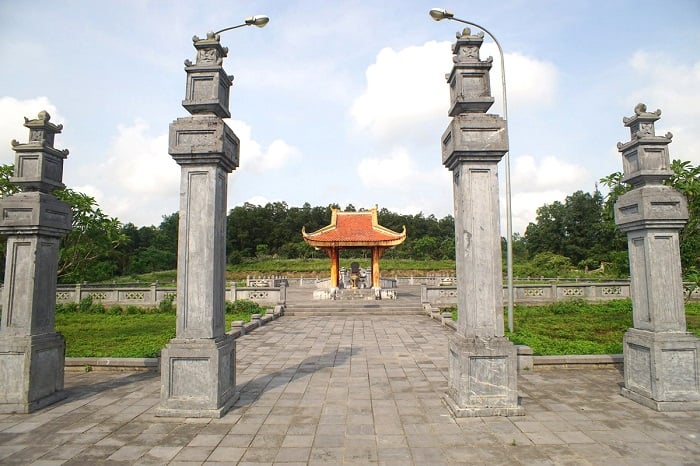
Lieutenant General Nguyen Huu Canh’s Tomb
Lieutenant General Nguyen Huu Canh’s Tomb is located on the An Ma mountain range in Truong Thuy commune, Le Thuy district, Quang Binh province. It is a nationally ranked historical relic with the tomb of Lieutenant General Nguyen Huu Canh, who made significant contributions to the southern expansion of Vietnam through diplomacy.
With numerous scenic spots, historical relics, and pristine natural landscapes, the tourist map of Quang Binh Province partly provides you with interesting coordinates for exploring the land of Quang Binh. Wishing you a meaningful and fulfilling journey!